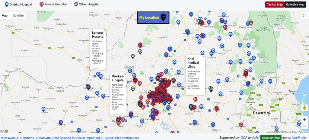
The main objective of the project was to create a tool to allow easy access to healthcare facility data for the general public, decision-makers, NGOs, and others, during the COVID-19 pandemic. The data is important to identify gaps, risks, and excess resources that can be deployed elsewhere.
The following were developed by the project:
- a geolocation map to show hospitals close to a person and the bed capacities of those hospitals
- data about all hospitals in South Africa ( private and public), their health care workforce available and the bed capacities
- a map showing the temporary emergency and field hospitals
The information is available in multiple languages through the Google Translate widget. The collection of mapping visualisations is freely accessible and source code for the data visualisation platform is under open source license.
The project was led by Nompumelelo Mtsweni, a Multimedia Producer at Good Governance Africa working with researchers at the University of Pretoria, University of Free State, CSIR, and Afrimapr.
Further information in this article by Data Science for Social Impact.
Today we make available a Health Facility Map of South Africa. Building on the work of volunteers. KDD’20 Workshop paper soon.
MVP⭐: Nompumelelo Mtsweni who has lead this whole project.
Map: https://t.co/RKqdOlbU6z
Repo: https://t.co/Ggn5VPnwFu
Blog: https://t.co/IVdHl2klMk pic.twitter.com/H6MufnzjCA— Dr. Vukosi Marivate (@vukosi) June 26, 2020

